Offline maps
A layout's aerial photo can be saved on the phone, with one tap in the checklist, for tracks with poor signal. Without an account, your runs never leave the phone.
Prepare your session, drive, then review every run in the paddock: its score and what cost you points, the top-down replay against your best, the video with the measurements. Feature by feature, here's what the app measures, what it shows, and what it does for you.
Screenshots and videos from the test version, with the app shown in French, taken on the Android emulator with the unit simulated on a PC or with demo measurements, on a layout set up for the example. None of the figures shown come from a real track.
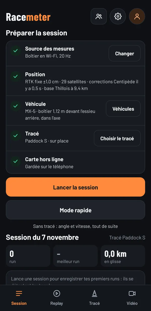
Five lines in order: the measurement source, the position, the vehicle, the layout and the offline map. Each one turns green when it's ready, and “Start session” lights up.
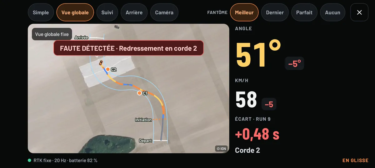
The phone in landscape, on a mount: the angle and speed in very large figures, the section of the layout you're in, and the RTK quality at the bottom.
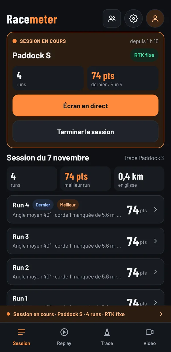
Once the session is started, runs are detected as you cross the start and the finish, and are recorded automatically, even with the screen off or on another tab. Nothing to touch between two runs.
A box shows the last score and reopens the live screen; a banner reminds you of the session on every tab. If the app stops, the session resumes when it restarts.
When the run is over, the score out of 100 appears on the live screen, with the gap to your best run and the faults recorded. It's calculated from what the unit actually measures:
Several scoring profiles, inspired by competition scoring systems, weight these criteria differently; a more playful profile, for friends, puts angle and swing first.
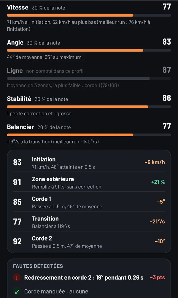
No black box: each criterion shows its weight, its score and what explains it, in figures. “71 km/h at the initiation”, “44° average, 55° maximum”.
Your car's silhouette, to the scale of your vehicle profile and at its true angle, replays the run on the IGN aerial photo, at 20 measurements per second. Below the map: the angle, speed, lateral g and current section.
As a ghost: your best run, the last one, any other, a friend's run received by file, or the perfect ghost, the line that would give the best score on this layout, limited to what your car has already done.
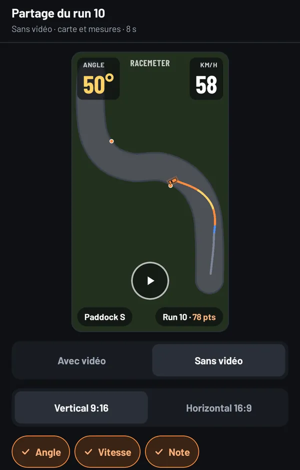
Film with the phone on its mount, or import the video from an onboard camera. The app syncs it to GPS time by itself, using the time recorded by the camera, then to the exact frame if needed.
It exports it as MP4 with the angle, speed, score and a mini-map overlaid, vertical for social media or horizontal. Nobody filmed? The top-down animation can be exported too, as shown here.
Your track has no marked edges? Trace its centre line and give its width. A layout can be kept offline and sent by file.
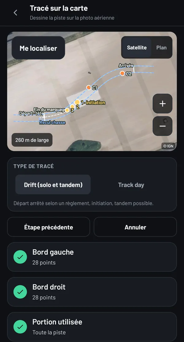
All three ways follow the same list: the layout type, the edges, the used portion, the start, the initiation, the clipping points and the zones, the finish, the name. Each completed step turns green.
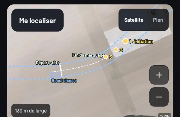
Choose your event's rulebook, or “Custom”: it prefills the start values and checks your layout, always as a warning, never a block.
Everything is drawn on the map, when creating the layout as well as on the live screen and the replay. A layout can also be a track day type: a start line and a finish.
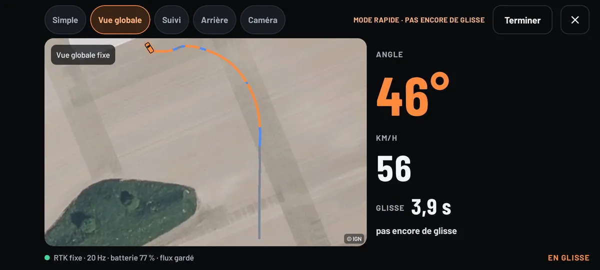
No layout to hand? One tap on “Quick mode” starts capturing. Every drift gets a score out of 100 as soon as it ends:
The path you take doesn't count: no line, no clipping point. Next to the score: the maximum angle and speed, the duration and the distance drifted. A drift of less than one and a half seconds is counted separately, without a score.
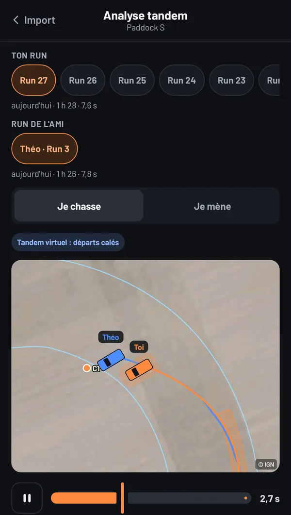
Your run and a friend's, received by file, replay together: synced on GPS time if you drove together, otherwise starting from the same line. You choose who leads and who chases.
The analysis measures the chase's proximity between the start of judging and the finish: the average gap and the share of time spent close. It also flags a chase that got ahead of the lead before the initiation.
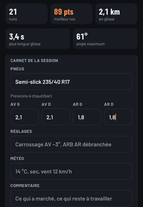
Each session keeps its runs, its figures and its sheet: tyres, hot pressures, setup, weather and comment. Enough to compare two setups from one day to the next.
Counters for fun: kilometres drifted, longest drift, maximum angle. A run or a whole session can be sent by file to a friend, who opens it in their app and can use it as a ghost.
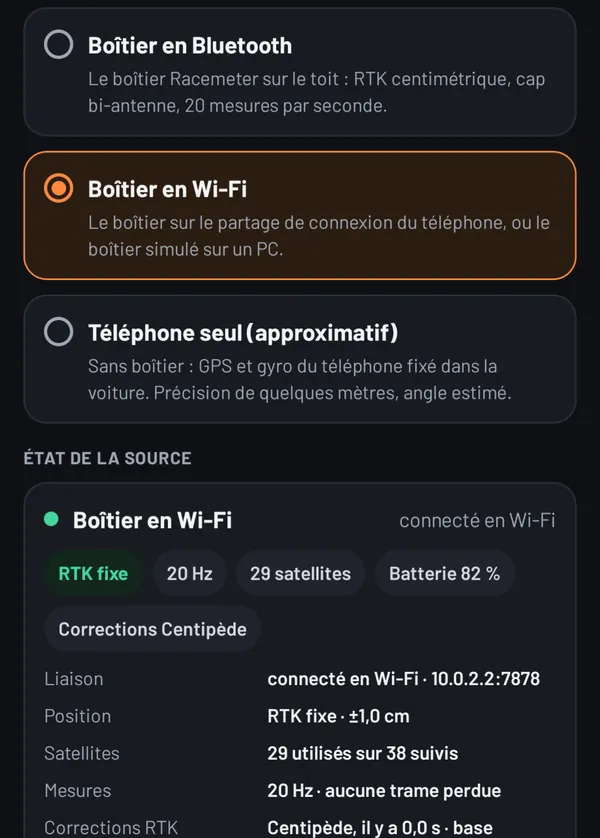
Three ways to measure, to choose in Settings:
The source status can be read at a glance: RTK fix or not, satellites, measurement rate, battery, age of the corrections.
A layout's aerial photo can be saved on the phone, with one tap in the checklist, for tracks with poor signal. Without an account, your runs never leave the phone.
No unit? The app works with the phone, mounted in the car. The day you get a unit, you pair it using its QR code, and the app offers to switch to it.
Wheelbase, widths, overhangs and position of the unit, with a measuring guide for each dimension. They draw the replay's silhouette and reference the measurements to the rear axle.
The beta is by invitation, with your Android phone. No unit needed to start.
Your friends, your layouts, your leaderboards
The social side, in beta
With an account, by invitation during the beta:
Everything is private by default: sharing a run, appearing in a leaderboard or showing your profile always needs your consent. Without an account, the app works entirely on the phone.
These two screenshots show the Community with simulated data: drivers, scores and activity are fictitious.